Western Sydney (LGA)
About the profile areas
The 2023 Estimated Resident Population for the Western Sydney (LGA) is 2,734,168, with a population density of 304.4 persons per square km.
Location and boundaries
The Greater Western Sydney Region is located in Sydney's west. The Greater Western Sydney Region is bounded by the Singleton Council area and Cessnock City in the north, the Central Coast Council area, Hornsby Shire, the City of Ryde, the City of Canada Bay, the Strathfield Council area, the Burwood Council area, the Inner West Council area, the Rockdale City Council area, the Georges River Council area, Sutherland Shire and Wollongong City in the east, Wingecarribee Shire and Upper Lachlan Shire in the south, and the Oberon Council area and Lithgow City in the west.
Traditional Owners
The original inhabitants of the Greater Western Sydney Region were the Bidjigal, Cabrogal, Darkinjung, Dharawal, Dharug, Gundungura, Gweagal and Tharawal Aboriginal people.
Important
|
Population2,734,168 2023 ABS ERP |
Land area8,982 square km |
Population density304.4 persons per square km |
Settlement history
European settlement dates from 1788 when the first farms were established. Gradual growth took place during the early 1800s, with land used mainly for timber-getting, sheep and cattle farming, crop farming and market gardening. Growth increased in the late 1800s and the early 1900s, aided by the opening of railway lines, improved access, the establishment of many industries, and tourism. Significant residential development occurred during the 1950s and 1960s, spurred by immigration, industrial growth and the construction of public housing estates. Rapid growth continued during the 1970s and 1980s. The population of the Region continued to increase from the early 1990s, rising from under 1.5 million in 1991 to 1.8 million in 2001, and then to over 1.9 million in 2011. Much of the recent growth has been in major release areas in Blacktown City, Liverpool City and The Hills Shire, and to a lesser extent in the Camden Council area. In other areas growth has been largely from urban consolidation and infill development (medium and high density housing) and redevelopment of former industrial sites for sporting, recreation, entertainment and housing. Population growth in the Greater Western Sydney Region is expected to continue.
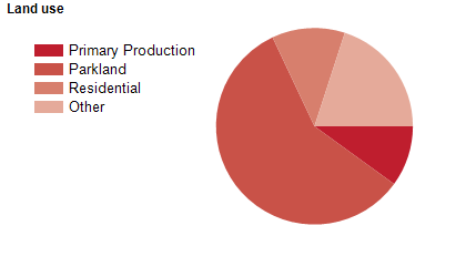
Land use
The Greater Western Sydney Region has substantial residential, rural, industrial, commercial, institutional and military areas. The Greater Western Sydney Region encompasses a total land area of nearly 9,000 square kilometres, including national parks, waterways and parklands. The LGA with the largest population in the Greater Western Sydney Region is Blacktown City, with Wollondilly Shire having the smallest population. The LGA with the largest land area is Hawkesbury City, with the Cumberland Council area having the smallest land area.
Transport
The Greater Western Sydney Region is served by the Hills Motorway (M2), the Western Motorway (M4), the South Western Motorway (M5), Westlink (M7), the Cumberland Highway, the Great Western Highway, the Hume Highway, Bells Line of Road, the Bankstown Airport, the Camden Airport, the Katoomba Airfield, numerous railway lines and bus services, and several ferries.
Major features
- Major features of the Region include Sydney Olympic Park,
- Camden Bicentennial Equestrian Park,
- Campbelltown Sports Stadium,
- Dunc Gray Velodrome,
- Eastern Creek International Karting Raceway,
- Lilys Football Centre,
- Menangle Park Paceway,
- Penrith Stadium,
- Sydney Dragway,
- Sydney International Equestrian Centre,
- Sydney International Regatta Centre,
- Sydney International Shooting Centre,
- Sydney Motorsport Park,
- Valentine Sports Park,
- Warwick Farm Racecourse,
- various golf clubs,
- Katoomba Scenic World,
- Sydney Ice Arena,
- Featherdale Wildlife Park,
- Golden Ridge Animal Farm,
- Australian Aviation Museum,
- numerous National Parks (Blue Mountains,
- Cattai,
- Dharawal,
- Georges River,
- Kanangra-Boyd,
- Nattai,
- Scheyville,
- Thirlmere Lakes,
- Wollemi and Yengo),
- various Regional Parks (Leacock,
- Penrith Lakes,
- Rouse Hill,
- Wianamatta,
- William Howe and Yellomundee),
- several state conservation areas (Bents Basin,
- Burragorang,
- Dharawal,
- Nattai,
- Parr and Yerranderie),
- various dams,
- Western Sydney Parklands,
- Chipping Norton Lakes,
- Lake Parramatta,
- Penrith Lakes Scheme,
- several rivers (Georges,
- Hawkesbury,
- Nepean and Parramatta),
- numerous major shopping centres (Bankstown Central,
- Campbelltown Mall,
- Castle Towers,
- Macarthur Square,
- Stockland Merrylands,
- Westfield Liverpool,
- Westfield Mount Druitt,
- Westfield Parramatta,
- Westfield Penrith and Westpoint Blacktown),
- various Central Business Districts (Bankstown,
- Cabramatta,
- Camden,
- Fairfield,
- Liverpool,
- Parramatta,
- Penrith,
- Richmond,
- St Marys and Windsor),
- TAFE NSW South Western Sydney Institute (Bankstown,
- Campbelltown,
- Chullora,
- Granville,
- Lidcombe,
- Liverpool,
- Macquarie Fields,
- Miller,
- Padstow and Wetherill Park Colleges),
- TAFE NSW Western Sydney Institute (Blacktown,
- Blue Mountains,
- Mount Druitt,
- Nepean,
- Nirimba,
- Richmond and The Hills Colleges),
- The University of Sydney (Camden and Cumberland Campuses,
- Coates Park Farm,
- John Bruce Pye Farm,
- Wolverton Farm and Animal Reproduction Unit & Plant Breeding Institute),
- Western Sydney University (Bankstown,
- Campbelltown,
- Hawkesbury,
- Nirimba,
- Parramatta and Penrith Campuses and Westmead Precinct),
- Elizabeth Macarthur Agricultural Institute (including Belgenny Farm),
- numerous hospitals (Auburn,
- Bankstown-Lidcombe,
- Blacktown,
- Blue Mountains District ANZAC Memorial Hospital,
- Camden,
- Campbelltown,
- Cumberland,
- Fairfield,
- Liverpool,
- Mount Druitt,
- Nepean,
- Queen Victoria Memorial and Westmead,
- and The Children’s at Westmead),
- Newington Armory,
- Lancer Barracks,
- RAAF Base Glenbrook,
- RAAF Base Richmond,
- Holsworthy Barracks,
- Defence Establishment Orchard Hills,
- Cobham Juvenile Justice Centre,
- Emu Plains Correctional Centre,
- John Morony Correctional Complex,
- Parklea Correctional Centre,
- Silverwater Correctional Complex,
- numerous museums,
- parklands and sporting facilities,
- and several wineries.
Included areas
- The Greater Western Sydney Region encompasses the thirteen local government areas of Blacktown City,
- Blue Mountains City,
- Camden Council,
- Campbelltown City,
- The City of Canterbury Bankstown,
- Cumberland Council,
- Fairfield City,
- Hawkesbury City,
- Liverpool City,
- The City of Parramatta,
- Penrith City,
- The Hills Shire and Wollondilly Shire.