Shire of Merredin
About the profile areas
The 2023 Estimated Resident Population for the Shire of Merredin is 3,268, with a population density of 0.99 persons per square km.
Location and boundaries
The Shire of Merredin is located in the Wheatbelt Region of Western Australia, about 260 kilometres east of the Perth CBD. The Shire of Merredin is bounded by the Shire of Nungarin in the north, the Shire of Westonia in the north-east, the Shire of Yilgarn in the east, the Shire of Narembeen and the Shire of Bruce Rock in the south, and the Shire of Kellerberrin in the west.
Traditional Owners
The original inhabitants of the Merredin area were the Nyaki Nyaki Noongar Aboriginal people.
Name origin
Merredin is thought to be named from an Aboriginal word meaning “the place of merritt’s (a local tree used to make spears)”.
Important
|
Population3,268 2023 ABS ERP |
Land area3,296 square km |
Population density0.99 persons per square km |
Settlement history
European settlement dates from the 1850s, although population was minimal until the 1860s, with land used largely for pastoral purposes. The township of Merredin was established in the 1890s, aided by the opening of the railway line. Growth took place during the early 1900s, with the population rising from about 2,800 in 1921 to 3,400 in 1933. Growth continued during the post-war years, with the population increasing to 3,800 in 1954, and then to a peak of 5,300 in 1966. The population declined from the late 1960s, falling to about 4,700 in 1971, and then to 4,500 in 1981. The population continued to gradually decline, falling to about 3,800 in 1991, and then to about 3,200 in 2011. In recent years the population has increased slightly, rising to about 3,300 in 2016.
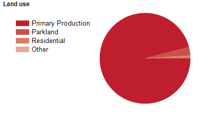
Land use
The Shire of Merredin is predominantly rural, with a township at Merredin, and smaller townships at Burracoppin, Hines Hill and Muntadgin. Land is used mainly for agriculture, particularly wheat and grain growing and sheep grazing. The Shire encompasses a total land area of 3,300 square kilometres.
Transport
The Shire of Merredin is served by the Great Eastern Highway, and the Prospector and MerredinLink rail services.
Major features
- Major features of the Shire include Merredin Peak,
- Totadgin Nature Reserve,
- Merredin Military Museum,
- Merredin Railway Museum,
- Cummins Theatre,
- Merredin Railway Water Tower,
- Merredin Showground,
- Roy Little Park,
- Tamma Parkland,
- Merredin Regional Community and Leisure Centre,
- Merredin Health Service,
- Collgar Wind Farm,
- Central Regional TAFE (Merredin Campus) and the Golden Pipeline Heritage Trail.
Included areas
- The Shire of Merredin includes the localities of Burracoppin,
- Goomarin,
- Hines Hill,
- Korbel,
- Merredin,
- Muntadgin,
- Nangeenan,
- Nokaning,
- Norpa,
- Nukarni,
- South Burracoppin and Tandegin.