Wellington Shire Community Profile
What is profile.id?
profile.id is a comprehensive socio-demographic profile of Wellington Shire and its suburbs / localities. The Community Profile presents results from the Census of Population and Housing for the following years: 2021, 2016, 2011, 2006, 2001, 1996, 1991.
The Community Profile enables analysis of population characteristics for different geographic areas and includes historical data to show how they have changed over time.
Wellington Shire Community Profile has been developed as a website linked to your Council website for ease of access by staff and the community, it can also be accessed directly at:
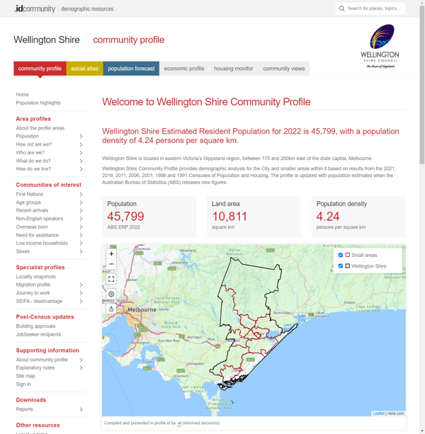
What does it look like?
Information is presented in a variety of formats. These include charts with comparative data and rates of change, tables with options for benchmarking and written analysis on trends and key points of interest.
Information is accessed from a menu with options for viewing the information for different geographic areas. You can also export reports and query the associated data sets.
What information is included?
Wellington Shire Community Profile is structured around four main questions. Within each of these, more detailed information is presented.
Population
- Population
- Service age groups
- Five year age groups
- Single year of age
Ethnicity
- Ancestry
- Birthplace
- Overseas arrivals
- Proficency in English
- Language spoken at home
- Religion
Education
- Qualifications
- Highest level of schooling
- Education institution attending
Employment
- Employment status
- Industries
- Occupations
- Method of travel to work
Unpaid work
- Volunteering
- Domestic work
- Care
- Childcare
Income
- Individual income
- Individual income quartiles
- Household income
- Household income quartiles
- Equivalised household income
Households
- Households summary
- Households with children
- Households without children
- Household size
Dwellings
- Dwelling type
- Number of bedrooms
- Internet connection
- Number of cars
Disability
- Need for assistance
Housing tenure
- Tenure overview
- Housing loan repayments
- Housing loan quartiles
- Housing rental payments
- Housing rental quartiles
Migration profile
- Migration summary
- Migration by location
- Migration by age
Journey to work
- Workers' place of residence
- Residents' place of work
SEIFA
- SEIFA - disadvantage
For which geographic areas?
Wellington Shire Community Profile provides comprehensive data for the following geographic areas:
|
|
|
|
|
|
|
|
|
|
|
|
How can I access Wellington Shire Community Profile?
Wellington Shire Community Profile can be accessed via the Wellington Shire website or at:
profile.id.com.au/wellington-vic