Powered by .id (informed decisions) for City of Whitehorse
.id community is an evidence base for over 250 local government areas in Australia and New Zealand, helping you make informed decisions.
LEARN MORE ABOUT .idprofile.id is a comprehensive socio-demographic profile of the City of Whitehorse and its suburbs / localities. The Community Profile presents results from the Census of Population and Housing for the following years: 2021, 2016, 2011, 2006, 2001, 1996 and 1991.
The Community Profile enables analysis of population characteristics for different geographic areas and includes historical data to show how they have changed over time.
The City of Whitehorse Community Profile has been developed as a website linked to your Council website for ease of access by staff and the community, it can also be accessed directly at:
Information is presented in a variety of formats. These include charts with comparative data and rates of change, tables with options for benchmarking and written analysis on trends and key points of interest.
Information is accessed from a menu with options for viewing the information for different geographic areas. You can also export reports and query the associated data sets.
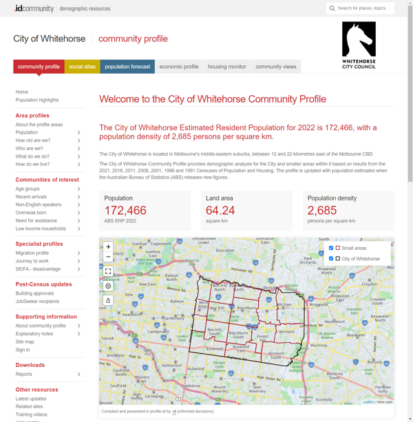
City of Whitehorse Community Profile is structured around four main questions. Within each of these, more detailed information is presented.
Population
Ethnicity
Education
Employment
Unpaid work
Income
Households
Dwellings
Disability
Housing tenure
Migration profile
Journey to work
SEIFA
The City of Whitehorse Community Profile provides comprehensive data for the following geographic areas:
|
|
|
|
|
|
The City of Whitehorse Community Profile can be accessed via the City of Whitehorse website or at:
profile.id.com.au/whitehorse
DISCLAIMER: While all due care has been taken to ensure that the content of this website is accurate and current, there may be errors or omissions in it and no legal responsibility is accepted for the information and opinions in this website.
Please view our Privacy Policy, Terms of use and Legal notices.
ABS Data and the copyright in the ABS Data remains the property of the Australian Bureau of Statistics. The copyright in the way .id has modified, transformed or reconfigured the ABS Data as published on this website remains the property of .id. ABS Data can be accessed from the Australian Bureau of Statistics at www.abs.gov.au. ABS data can be used under license - terms published on ABS website. intermediary.management@abs.gov.au if you have any queries or wish to distribute any ABS data.