City of Kingston
About the profile areas
The 2023 Estimated Resident Population for the City of Kingston is 163,724, with a population density of 1,793 persons per square km.
Location and boundaries
The City of Kingston is located in the middle and outer southern suburbs of Melbourne, between 15 and 34 kilometres south-east of the Melbourne CBD. The City of Kingston is bounded by the City of Glen Eira and the City of Monash in the north, the City of Greater Dandenong in the east, Frankston City in the south, and Port Phillip Bay and the City of Bayside in the west. The City of Kingston's boundaries are Centre Road and Westall Road in the north, Springvale Road and the Mornington Peninsula Freeway in the east, the Eel Race Drain in the south, Port Phillip Bay in the south-west, and the Frankston railway line and Charman Road in the west.
Traditional Owners
The original inhabitants of the City of Kingston were the Boonwurrung and Woiworung Aboriginal people.
Name origin
The City of Kingston is thought to be named after the King Brothers, a pioneering family in the area, who held thousands of acres referred to as "Kings Land" or "Kingstown".
Important
|
Population163,724 2023 ABS ERP |
Land area91.31 square km |
Population density1,793 persons per square km |
Settlement history
European settlement dates from the 1840s when pastoral leases were established. Land was used for grazing, and later market gardening. Parts of the municipality continue to be employed in this way, particularly in the Heatherton area. Suburban development prior to World War II was mainly along the Frankston railway line, constructed in 1882, which runs the length of Kingston. Significant residential development occurred in the immediate post war years, particularly in Cheltenham, Highett, Moorabbin, Mordialloc and Parkdale. This period also saw the establishment of Kingston's industrial base. Growth in the 1960s and 1970s was largely in the suburbs of Clayton South and Dingley Village and the inland parts of Cheltenham and Mordialloc. Development from the 1980s was mainly in Aspendale Gardens, Chelsea Heights and Patterson Lakes, and the new suburb of Waterways. The population continued to increase from the 1990s, including infill developments on the former Epsom Training Track in Mordialloc and The Heath Estate on part of the Kingston Centre site in Heatherton.
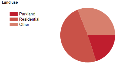
Land use
The City of Kingston is a residential and industrial area, with substantial areas of open space. The City features significant residential areas in the west and south, while there are major industrial nodes around Moorabbin, Braeside, Moorabbin Airport and Clayton South. The central and eastern areas contain significant areas of primary industry, such as high-value horticulture, flower cultivation and quarrying. There are also substantial areas designated for leisure and environmental value, including golf courses and wetlands. The City encompasses a total land area of 91 square kilometres, including significant areas of foreshore.
Transport
The City of Kingston is served by the Mornington Peninsula Freeway, the Nepean Highway, Moorabbin Airport and the Frankston railway line.
Major features
- Major features of the City of Kingston include various beaches along Port Phillip Bay,
- Westfield Southland Shopping Centre,
- Moorabbin Direct Factory Outlets,
- Braeside Park,
- Moorabbin Oval,
- Karkarook Park,
- Australian National Aviation Museum,
- Oakleigh Go-Kart Track,
- Kingston Arts Centre,
- Waves Leisure Centre,
- Don Tatnell Leisure Centre,
- Holmesglen TAFE (Moorabbin Campus),
- Edithvale-Seaford Wetlands Environmental Area,
- The Kingston Centre,
- numerous golf clubs and courses (Capital,
- Commonwealth,
- Edithvale,
- Kingston Heath,
- Patterson River,
- Peninsula Kingswood,
- Rossdale,
- Southern,
- Spring Park,
- Spring Valley and Woodlands) and the Patterson River.
Included areas
- The City of Kingston includes the suburbs of Aspendale,
- Aspendale Gardens,
- Bonbeach,
- Braeside,
- Carrum,
- Chelsea,
- Chelsea Heights,
- Cheltenham (part),
- Clarinda,
- Clayton South,
- Dingley Village,
- Edithvale,
- Heatherton,
- Highett (part),
- Mentone,
- Moorabbin,
- Moorabbin Airport,
- Mordialloc,
- Oakleigh South (part),
- Parkdale,
- Patterson Lakes and Waterways.